Satellite Imagery for Roofing Leads
A roofing company was door-knocking blind. We trained a model to analyze satellite images and identify roofs showing signs of wear, so their sales team could focus on homes that actually need work.
The company had 8 canvassers knocking on 200+ doors a day with a 2% close rate — 98 out of 100 conversations went nowhere. After storms they'd blanket entire areas hoping to find damage. Sales reps were burning out, and the cost to acquire each customer was too high.
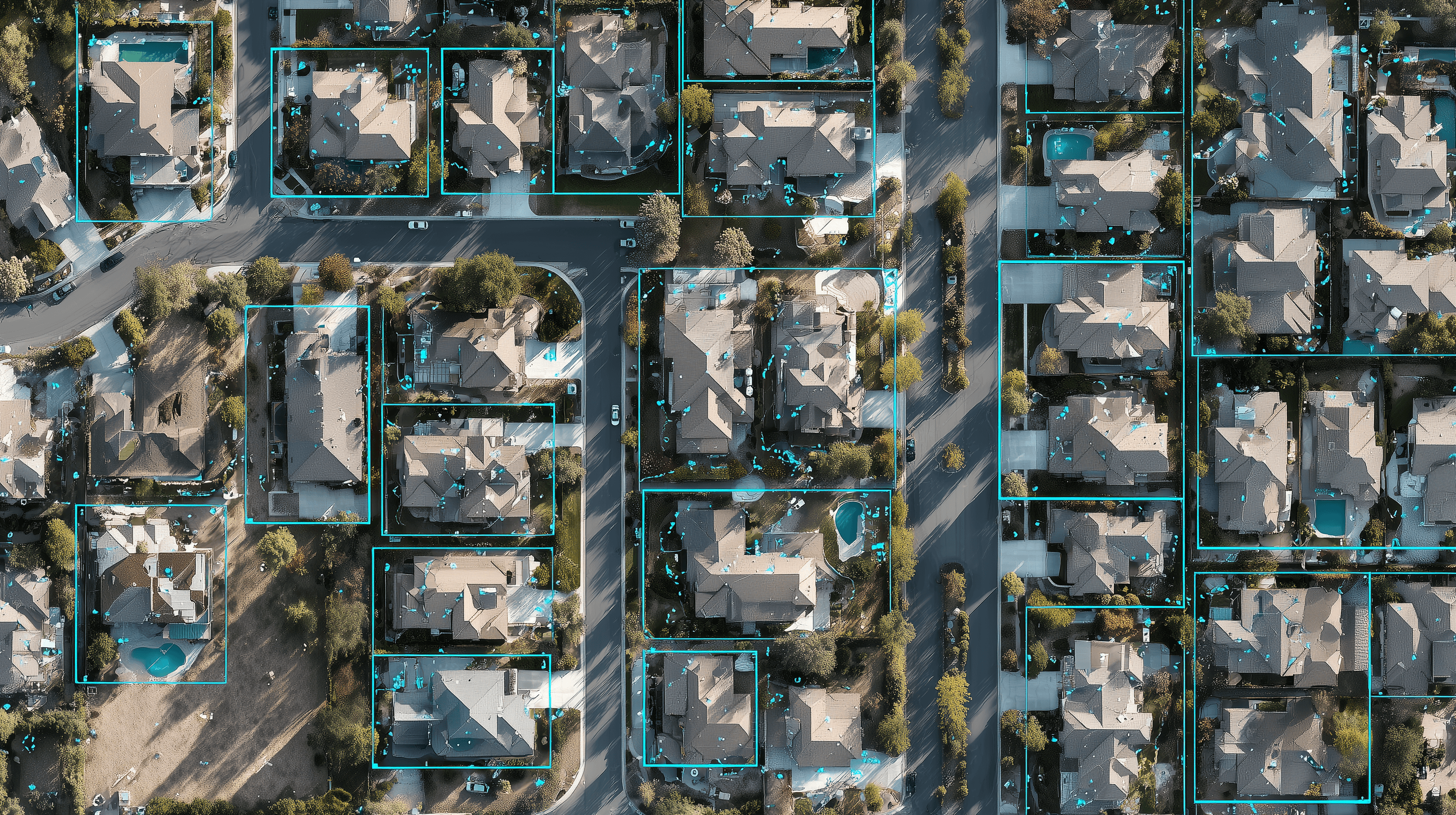
We trained a model on thousands of labeled satellite images to spot signs of roof distress: missing shingles, discoloration, sagging, moss growth, and storm damage. It scores every rooftop in a target area and generates ranked lead lists. Sales reps now only visit homes with a high probability of needing work.
Close rate went from 2% to over 8%. The team cut canvassing time by 65% while closing more deals. After storms, they can identify affected properties in hours instead of weeks of driving around.
What happened
- ·Close rate went from 2% to over 8%
- ·Canvassing time reduced by 65%
- ·Customer acquisition cost cut by more than half
- ·Storm damage identified in hours, not weeks
Working on something similar?
We'd be happy to talk through your situation and see if we can help.
Get in touch